When a site is being evaluated for development, the person responsible for developing the property would order a geotechnical assessment. The primary concern is the foundation and how to properly design the foundation for the building. For example, if builders do not put down the right type of slab for the type of earth the are building on, the foundation will be unstable and the building may collapse.
Performing a Geotechnical Geological Assessment
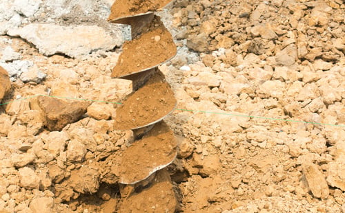
When performing a geological assessment, the primary concern is how to design the building’s foundation. This is done using a drilling rig to perform the soil boring and then a split spoon sampler is used to collect soil samples. We use the Unified Soil Classification System to classify the soil type.
When collecting soil samples, we are using a hammer to drive the split spoon into the ground. The relative density of the soil is determined by how many blows it takes to drive that split spoon one foot into the ground. So, if it takes 30 blows, your end value would be expressed as 30 blows per foot.
Density standards are as follows:
- 0 – 3 blows is very loose
- 4 – 9 blows is loose
- 10 - 29 blows is medium
- 30 – 49 blows is dense
- 50 – 80 blows is very dense
- 80+ blows is extremely dense
These standards are used to determine the type of foundation that is needed for the building.
Characterizing Soil and Rock
When Handex performs a site assessment report, there are two main things we need to accomplish with respect to characterizing the soil and/or rock beneath the site:
1. Classify the Lithology
The site lithology, or the type of soil and rock beneath the surface, can be determined by collecting soil and rock samples from different depth intervals. Sometimes we’ll do a deep soil boring with continuous sampling or we might do one deeper just for lithologic purposes only.
Soil borings are prepared from the soil surface to the water table and may be anywhere from 2 to 30 feet deep with continuous sampling the whole way down. This is done to help us obtain a better picture of the geology and lithology of the site.
In Florida, for example, the peninsula is composed primarily of limestone so we see limestone most often.
2. Classify the Soil
Soil types are classified based on the size of the particles. There are three main types of soil:
- Sand - This is the largest
- Silt - This is smaller than sand, but you can still see the individual particles
- Clay - Clay particles are the smallest and cannot be seen with the naked eye
Classifying the soil type is important because the permeability will impact the remedial approach. For example, if clay is present beneath the ground, we cannot do a chemical injection because it won’t move through the clay.
Does My Site Need a Geotechnical Assessment?
When evaluating a site for development, a geotechnical assessment is often needed to identify the type of earth that exists below the ground. This will help determine the best foundation for the structure. The two main things we look at are the soil and lithology types to assess how they will interact with the proposed design.
About Handex
Handex Consulting & Remediation, LLC provides professional environmental remediation, engineering, construction and industrial services including sludge dewatering. Handex has a passion for quality and a commitment to provide outstanding customer service. For over 40 years, Handex has developed solutions for our clients’ environmental needs that are cost-effective, regulatory compliant and consistent with objectives.